Gonna build a mountain and a daydream,
The Monkees.
gonna make ‘em both come true…
Week 4 started with a long day’s walking. From Buenba Flat the track climbs towards Mt Murphy before dropping to Buckwong Huts, where I had lunch. I left the AAWT to follow the steep Buckwong Track (350m climb over 2.1kms). I sang the entire Abbey Road a few times to take my mind off the walking.
I followed the Misery Trail south for 2 hours. It was bleak, a misty trail flanked by the charred remains of a forest after a horrendous bush fire. Blackened trunks loomed spectrally and time lost meaning.
I lost the track when I left the Misery Trail, all route markers having been destroyed by bushfires. The track descended 500m and into areas untouched by fire, which was a relief. I came in contact with my first brumbies – I would see many more over the next fortnight.
The morning of Day 23 involved pleasant bushwalking for 10kms, including following a creek with some picturesque waterfalls. Then a short climb to the Cowombat Track. I would be walking mostly on fire trails for the next fortnight.
I followed the fire trail for 15kms to Cowombat Flat and made camp. It’s a great spot with open grassy plains. I could hear wild dogs howling to each other through the night.

The next morning I explored around the area and examined the remains of an RAAF plane that crashed at Cowombat Flat in 1954. The wreck was scattered over a wide area.

Soon afterwards I crossed a stream that is the beginning of the Murray River and entered New South Wales. There was no border control here!

The AAWT follows the Pilot Creek Trail and the Snow Gums Trail before looping back to the Cowombat Trail. Here I took a side trip and climbed The Pilot, mostly off track with the occasional vague foot pad. The clouds cleared intermittently to reveal views.

Then back on the fire trail which took me to Tin Mine Huts, built for a short lived mining venture then occupied for many years by an eccentric recluse named Charlie Carter.
I shared the space with the brumbies, who were quite unaffected by my presence. Not having seen a soul for 5 days I struck up a one-sided conversation. I can vouch for their noisey eating, the sound of which lulled me to sleep that night.

It was a cold night and there was frost on the ground on the morning of Day 25. The brumbies were gone (perhaps they knew somewhere warmer nearby).

At Tin Mines Hut the track changes name from Cowombat Trail to Cascade Trail, which I followed throughout the day. I had lunch at Cascade Hut, charmingly hidden just off the track. Here I could have a conversation with real people (not horses) – day walkers from Thredbo.

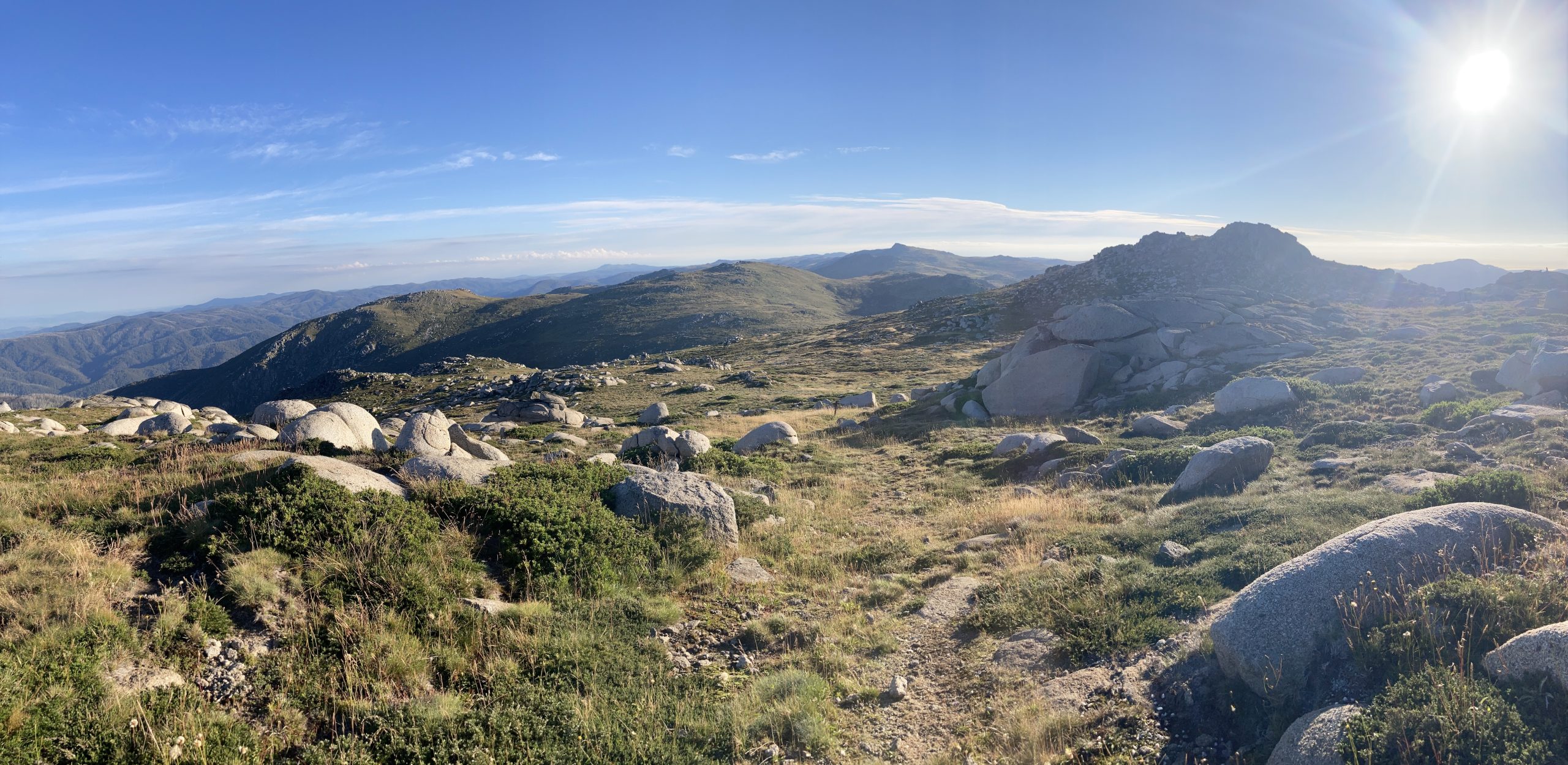
The track continues up over Bobs Ridge, where you get the first real views of Rams Head and the Main Range.

I followed the track down to the Thredbo River which I crossed on the foot bridge, then continued to Alpine Way. My next food drop was nearby, up above Dead Horse Gap, where I made camp. There were no brumbies there that night, although they had been there when I placed the food drop, well and truly alive despite the location’s name.
Day 26 was fine and sunny. I spent the morning following the Dead Horse Gap track up to the Kosciuszko Walk, which was crowded with day walkers. After a week being mostly by myself it was a bit of a culture shock.

There was a party atmosphere at the summit, with hundreds of people and a queue for a selfie at the summit marker.

After leaving Mt Kosciuszko I continued north on the Main Range Walking Track, trying to avoid the numerous joggers involved in a charity run.
The route around Mt Northcote was closed for repairs which would take 3 months but, lucky me, was open this weekend only. I proceeded on past Mt Twynam and camped in the saddle below, near Mt Anton. It was a popular area being a long weekend.

Day 27 dawned sunny and clear. I was having a lot of luck with the weather. I could see quite a few tents pitched near where the track from Guthega meets the Main Range.

I proceeded north through Consett Stephen Pass, after which the route became vague, then went off track across the Rolling Grounds. I love the open alpine country around here. It took me a while to find the top of the footpad to Whites River Hut, but once found it was easy to follow. At the hut I was greeted by a walking group who insisted on a photo, and I was happy to oblige.

I was now on a fire trail, up through Schlink Pass and past the Schlink Hilton (hut), before turning off towards the picturesque Valentine Hut.

At Valentine Hut I was extremely lucky to meet the caretaker, his mother and 3 sons. They had just finished a working bee over the long weekend and were incredibly hospitable, plying me with tea and goodies. Real tea with real milk, what a luxury!

I camped near the hut for the night. The next morning (Day 28) was cloudless. After crossing Valentine Creek I climbed the hill and looked back to the hut.

I followed the track to Grey Mare Hut, which I visited to install a new visitors’ book (the previous one was full and had been removed by the caretaker).
Then I continued north, stopping for a chat with a bike rider engaged in a long distance race to Canberra. Shortly afterwards I stopped at the Tumut River for lunch.
The bulk of Mt Jagungal loomed over me to the east as I continued on the Grey Mare Trail, past O’Keefes Hut and on to Mackeys Hut.

So ended Week 4 of my AAWT walk, the highlight of the trip. Wonderful conditions over the Main Range, finishing with a classic rustic wooden slab hut to camp next to.
Physically, I am still all good. The toe abrasions have healed. My left knee gets a bit tight – sore when stepping over logs but fine for walking.
Some progress totals:
Steps: 860,000
Snakes sighted: 19
Leaches sighted: 1
Other AAWT walkers sighted: 3
Flies sighted: Plenty, but less now as the weather gets cooler
Brumbiesc sighted: 14
Deer sighted: 2
