After my usual breakfast of porridge and chocolate, I left the hut in the company of Jenny and Kirsten. It was a beautiful morning with clear blue skies and fresh air.

The track follows the southern bank of the Dart River, generally traversing the slopes above the river (and out of the flood zone)
After 2 km, views open up along the valley of the Whitburn River on the northern side of the Dart River valley, leading up to the Whitburn Glacier and the Snowdrift Range.

The track continues through mountain forests with dappled light falling through the forest canopy.

The track crosses a number of side creeks. There are no bridges over the majority of these creeks. Crossing them is a relatively simple exercise because it hasn’t been raining and so the water levels are low, but I can imagine that there would be times that these creeks become impassible.

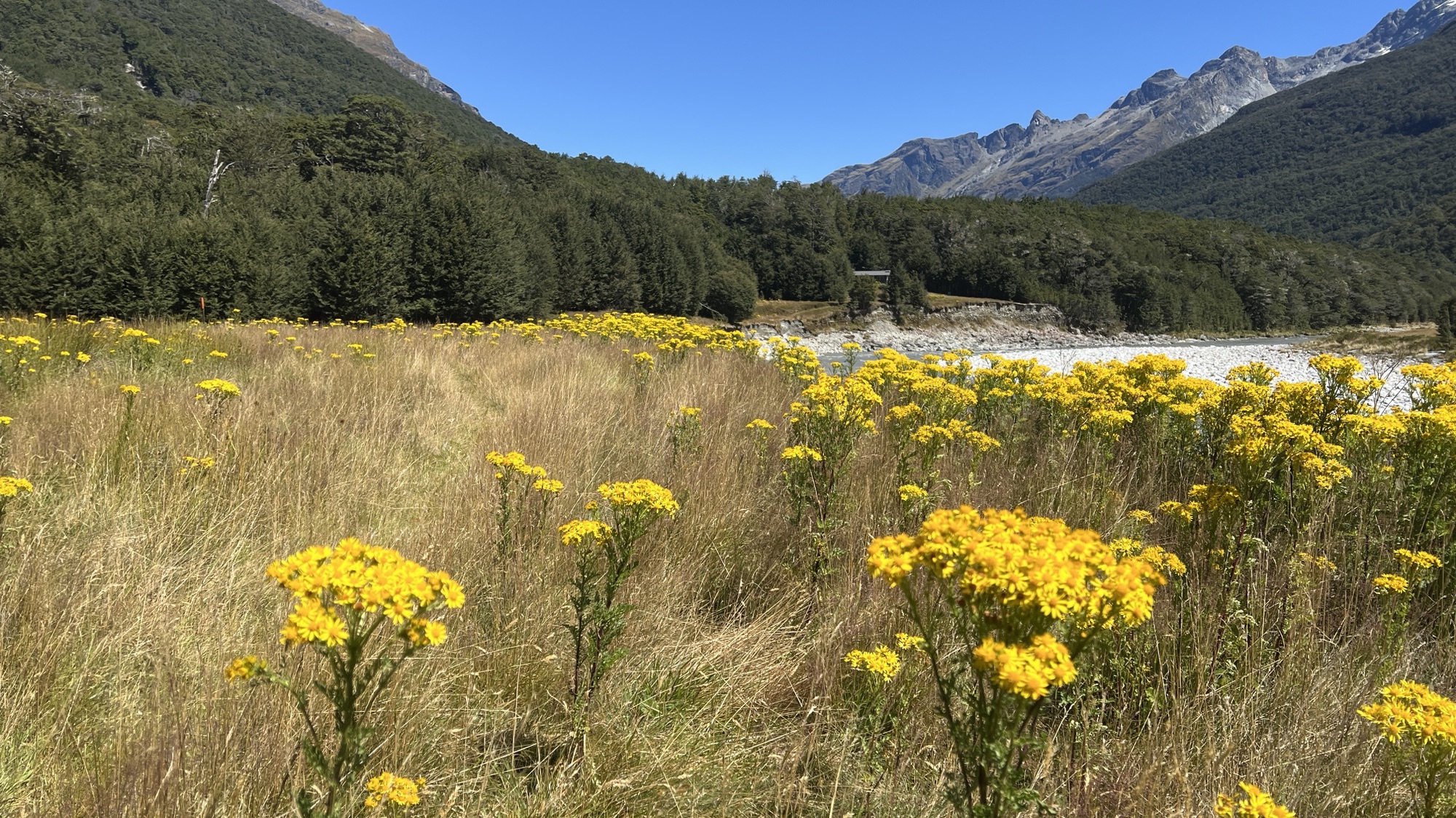
At times the river valley opens out. The river itself can become a wide, gravel-covered expanse. Occasionally the track descends and meanders across the gravel.

The majority of the track crosses alpine meadows above the gravelly river base. There are occasional glimpses of ducks, their heads protruding comically above the level of the grass.

The topographic map indicated a rock bivouac near the track. Jenny and I decided to investigate and searched off-track to the precise point shown on the map. What we found was decided underwhelming, a rock with a very small overhang. There was, however, one resident. A robin that jumped around and came very close to us.

We continued on the track for another couple of hundred metres where we passed a sign and a clear footpad to the (real) rock bivouac. The place marked on the map was incorrect. Jenny and Kirsten continued on the track while I decided to detour to the rock bivouac.
This was definitely a place worth investigating. An extremely large overhang with plenty of room for camping if you were unlucky enough to get caught in a storm. A fireplace had been built from local rocks, and there was also some cooking equipment in evidence. I decided to have my lunch here.

The rock bivouac is adjacent to a mountain stream that provides fresh water. There are also a lot of mushrooms in the area, which make for a magical setting (but I’m not sure I’d want to eat any).

I continued back along the trail and eventually caught up with Jenny and Kirsten. The walk from Dart Hut to Daleys Flat Hut is about 19 km. As we neared Daleys Flat Hut there is a bridge across the Dart River. This bridge consists of only three wires with some netting. I was glad I didn’t have to cross it because it looked somewhat flimsy and intimidating.

500m later we could see Daleys Flat Hut. There were many walkers who had come from the other direction that day so the hut was quite full, a contrast to the previous three nights where there were only eight people in the huts.

Most people stayed indoors as the sand flies at Daleys Flat are voracious and very quick to settle on any stationary targets.

