I didn’t get a great sleep last night. There had been stories of mice in the hut and, indeed, I found a dead mouse nearby on the track. However, it wasn’t the mice, but the many humans in the hut that kept me awake, what with snoring and talking and early morning alarms.
I wanted to make an early start, having heard stories from other walkers that the track was going to be difficult today. And the dawn brought another beautiful day with clear blue skies.

After about a kilometre of walking through forests, the track reached an open area known as Dredge Flat. A large, industrial dredge had been installed on the flat around 120 years ago. It only operated for a couple of years looking for gold which wasn’t found. There’s no sign of it now.
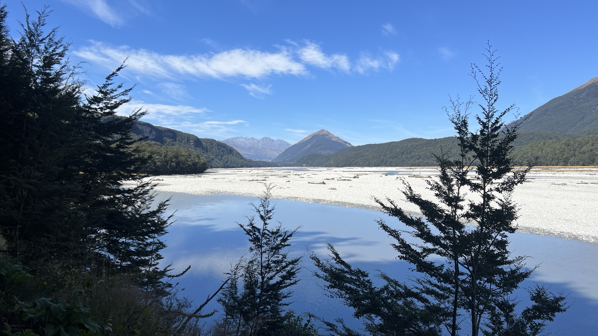
The track continued along the eastern side of the Dart River which, at times, widened to about a kilometre of water, gravel and sandy flats. On the western side of the river, snowcapped mountains were visible.

The track was difficult in places, but no more so than it had been on the previous days. There were plenty of tree roots, and the occasional fallen tree to climb over, but this was standard for the Rees Dart Track.

Some parts of this track had been closed in 2014 for three years, and had been repaired and reconstructed, including an area bounded by a steep drop to one side and an overhanging cliff to the other.

When the track wasn’t located on the riverfront, meadows or gravelly flats it travelled through lush forests.

Most of the side creeks are crossed without bridges, although there is a bridge across the Bedford Stream, which is constantly flowing and would be impassible in rainy conditions.

I stopped at this point to have a feed, and to swat the sandflies that quickly gathered around me.

Upon reaching Chinamans Bluff there was a short diversion to another rock bivouac. This was not quite as large as the previous day’s, but would still provide reasonable shelter in a storm.

Beyond Chinamans Bluff, the river widened considerably.

We reached the bus shelter with an hour to spare. Another man arrived having done a massive walk from the Dart Hut, which had taken us two days. Together with my walking companions, Jenny and Kirsten, we waited for the bus.

When the bus arrived, the bus driver gave us a guided tour to Glenorchy, describing all of the movies that have been shot on location in this area (Lord of the Rings, X-Men – Wolverine, etc).
