A year earlier I had completed the Three Capes Track in Tasmania with my two elder brothers, Phil and Andy, and my younger sister, Rachel. We enjoyed it so much that we immediately began making plans for walking together again.
We wanted something with huts each night, a well-maintained track, and with some alpine scenery.
And so it was that, a year later, I met up with Phil and Andy to do the Routeburn Track in New Zealand.

One logistical issue is transport. The track is 33km long but it is a 340km drive from the beginning to the end. We used a car transfer service (trackhopper.co.nz).
The weather forecast was for rain in the morning, but clearing later in the day. We figured that we could take our time getting to the start of the walk and wait for the rain to clear. After collecting our lockbox for the car keys we went to a cafe in Glenorchy and had some morning tea. The rain wasn’t easing, so we decided to get started.

The walk begins at the Routeburn Shelter, which is about a half hour drive from Glenorchy.

We parked the car and, after the usual amount of faffing around, started walking. There were a lot of people coming in the other direction who had walked that morning from the Routeburn Falls Hut and were planning on catching a bus back to Queenstown. It must have been a wet morning because they all looked soaked and were very happy to be finishing.

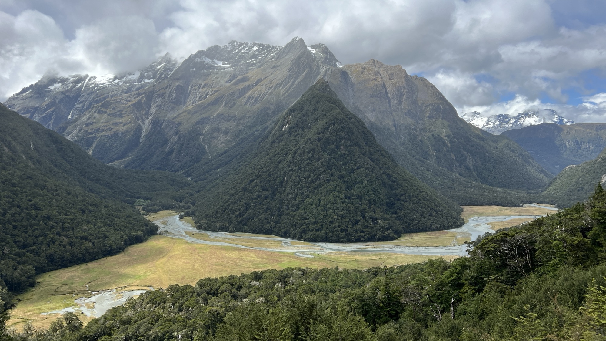
A “burn” is another name for a river or waterway. In this case, the river is called the Route Burn, because there is a route that follows the burn. I guess it all makes sense. The track follows the Route Burn on the first day. It begins climbing slowly and then more steeply until it reaches a pass and enters the Routeburn Flats. Along the way, it passes a number of creeks and waterfalls.

The Routeburn Flats are a wide grassy area at the confluence of the left branch and the north branch of the Route Burn. There is a hut located next to the river at this point. We stopped to have some lunch. Phil made friends with the local birds.


After lunch, we began the climb towards the Routeburn Falls Hut. It is only about 2 km. As you climb the views improve, with the flats below and the mountains around.


We arrived at the Routeburn Falls Hut late in the afternoon. The hut was quite full. It is a modern hut with great views down the valley and around the mountains.


Being the first night of our walk, we had brought fresh fish with us to eat. We fried the fish and had a good meal in the common kitchen area. At 7:30 pm the Department of Conservation Ranger gave us a talk, outlining the features of the walk ahead and the safety procedures to be followed whilst in the hut and on the track.
