After climbing a great hill,
Nelson Mandela.
one only finds that there are many more hills to climb.
After breakfast and packing up camp, I went for a side trip to climb Mount Oakleigh. This is the highlight of my Overland Track adventure.
The track up Mount Oakleigh is a joy. It begins by crossing a grassy plain, and then climbs through a series of forests, each one different to the preceding one. There are areas of open woodland, there are alpine environments, there are pandani groves.
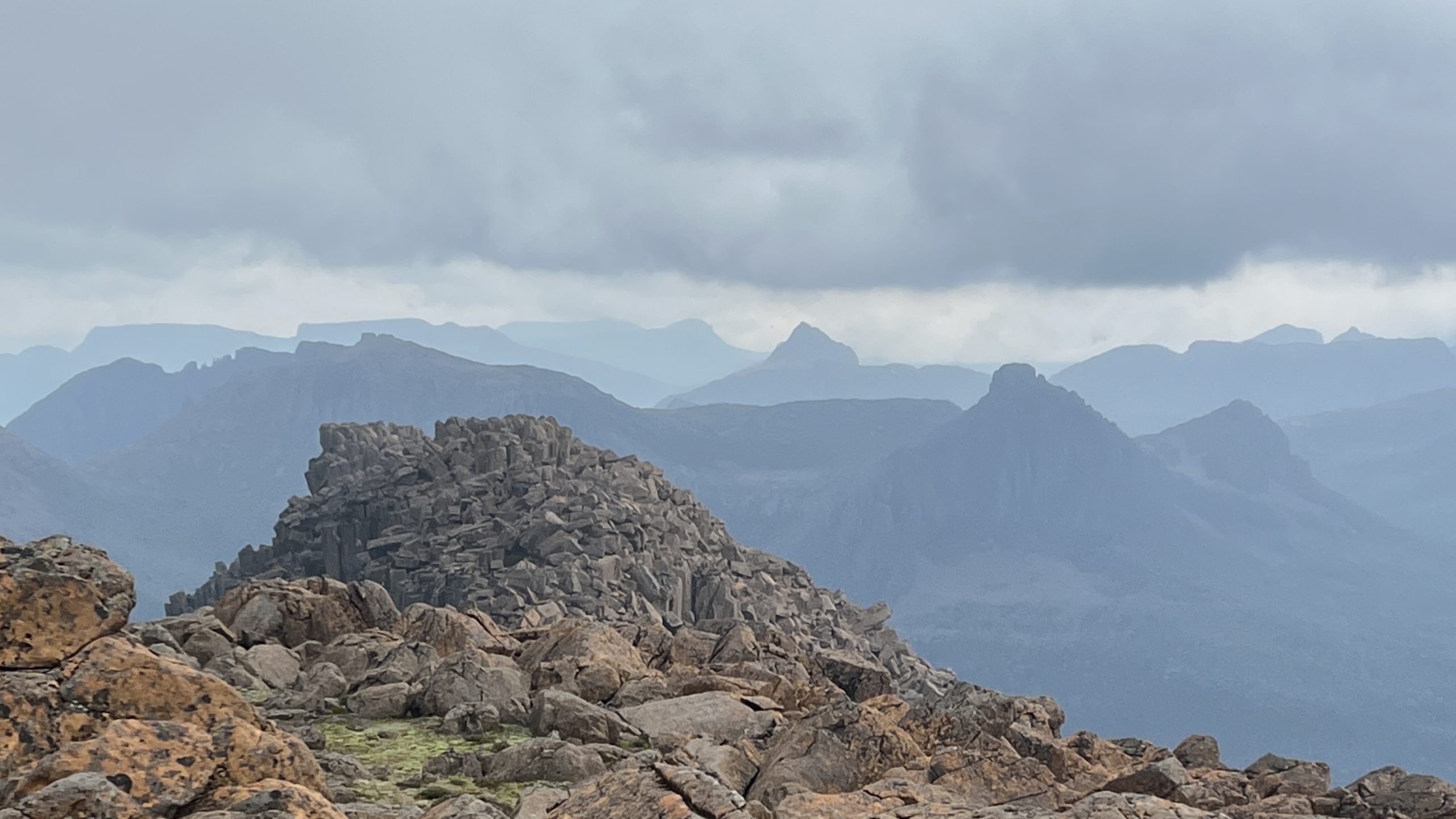
When you climb to the upper part of Mount Oakleigh, the track then traverses across. The landscape is open, scrubby, and wind swept. It has a wild look.
The track ends with a view looking over the “fingers” of rock that protrude from the eastern side of Mount Oakleigh. The view extends across the valley of the River Forth and around to the north, where the true peak of Mount Oakleigh lies.

The descent of Mount Oakleigh takes you back through the variety of forest vegetation that you went through to reach the summit. It has an ancient feeling, almost prehistoric, with the trees and fallen logs covered thickly in moss and the pandani standing in groups like a Dr Seuss drawing.

When I returned to New Pelion Hut, it was empty. Everyone had continued on their walks towards the south, and Mount Ossa.

I loaded up my pack and started walking again. The Overland Track is mostly boardwalked, although the quality varies from place to place. Some of the original boardwalk still remains.

After a little over an hour, I had climbed to Pelion Gap. What a surprise, and a wonderful experience. The view that was previously hidden opens out to the south, a landscape of mountain ranges and deep valleys, even more scenic than what I had seen on the previous 2 1/2 days.

From Pelion Gap, I had a choice: climb to the east up Pelion East, climb to the west up Mount Ossa (Tasmania’s highest mountain), or continue southwards on the Overland Track. I put my pack down and prepared to climb Mount Ossa. There were already a number of packs there, covered and secured against marauding currawongs.

The track up Mount Ossa is clear in most places, but there was one point where I lost the correct path. It was clearly signposted to go a different way, but I couldn’t find a different way, and so ended up climbing a somewhat difficult chimney before re-joining the track a little further on.
Near the peak of Mount Ossa there are 360° views. Fantastic! The final scramble to the peak is over a series of large boulders and is a bit tricky.

I descended Mount Ossa and then walked another one and a half hours southwards to Kia Ora Hut. Here I re-met my friends from the previous day and enjoyed good dinner conversation. I pitched my tent with a view to Pelion East.

However, as the night wore on a cheeky possum tried to steal my food bag. At 10:30 pm I packed up all my gear, walked back to the hut, and slept on the floor of the common room.
