There was a beautiful rainbow this morning. I looked out the kitchen window of the hut and saw it across the valley. It was a portent of good things to come. The weather forecast had been for a lot of rain today, but it looked like it was clearing.

I left the hut fairly early by myself and began walking up the valley. The vegetation is light, and the forests have receded into the background. The Rees River becomes more like a creek the further you go up the valley.

All the way along the walk, both sides of the valley are framed by mountain ranges with snow and glaciers visible at the top.

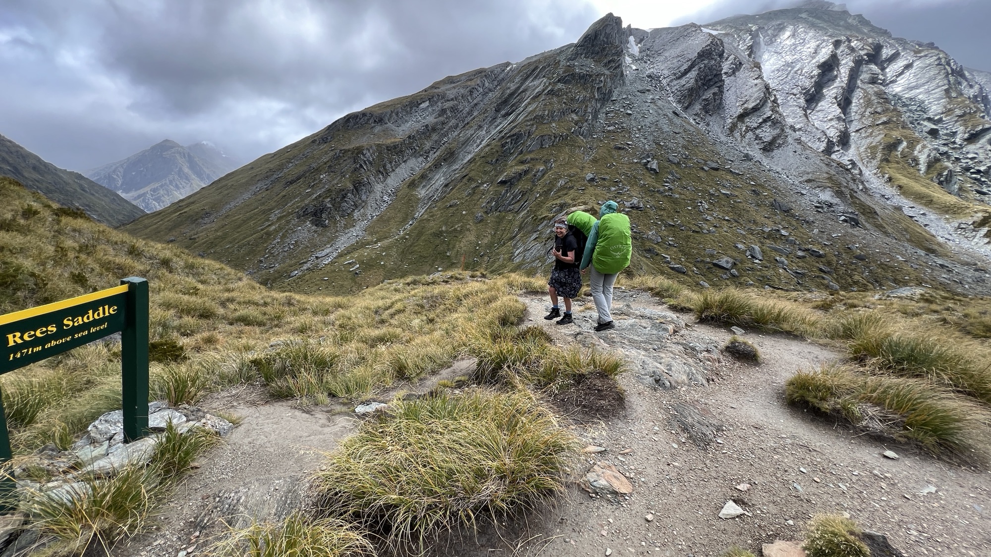
At the head of the valley is a steep 100m climb to the Rees Saddle. The track is clearly marked up the left-hand side of the head of the valley.

Two-thirds of the way up the climb, I saw the entrance to Lancaster Cave on the opposite side of the valley, I sidled across to the cave entrance and explored within. The cave extends more than 20 m into the side of the hill. It would provide shelter in a storm if necessary.

I then sidled back to the track and found that Jenny and Kirsten had caught up with me. Together we ascended to the Rees Saddle.
The wind was gusting strongly in the saddle, perhaps up to 80 km/h.

We now had views of the Snowy Creek valley, coming in from our right, and then heading down to the left towards the Dart River.
The track follows the western side of Snowy Creek for about 2 km, well above the water level. The wind was blowing a gale and, as I rounded one corner on the track, I almost got blown off.
The track then descends to a bridge across Snowy Creek. This bridge is removed during winter.

The track then continues on the eastern bank of Snowy Creek for a further 1.5 km. The Dart River valley opens up in view as the track descends, including views up to the Hesse and Marshall Glaciers.

When the track approaches the Dart River it turns towards the west and enters an area of forest before reaching a swing bridge across Snowy Creek. The Dart Hut is located on the banks of the Dart River.

As the afternoon progressed, the others, who were staying the previous night at the Rock Shelter Hut began to arrive. The young men from Noosa (Lachie and Lachie) were brave enough to have a swim in the freezing Dart River. Good luck to them! The rest of us relaxed on the sunny deck, or within the common room, squashing blowflies for sport.
