The weather forecast has been terrible for today. Heavy rain. All day. But that’s not how it turned out. In fact, by the end of the day my face was sunburnt and I had a “beanie line“, much to the amusement of my companions.
My plan today was to make a side trip to the Cascade Saddle. However, the logbook in the hut had a note from a few days earlier, saying that an avalanche had blocked the track. It didn’t say where the avalanche was.
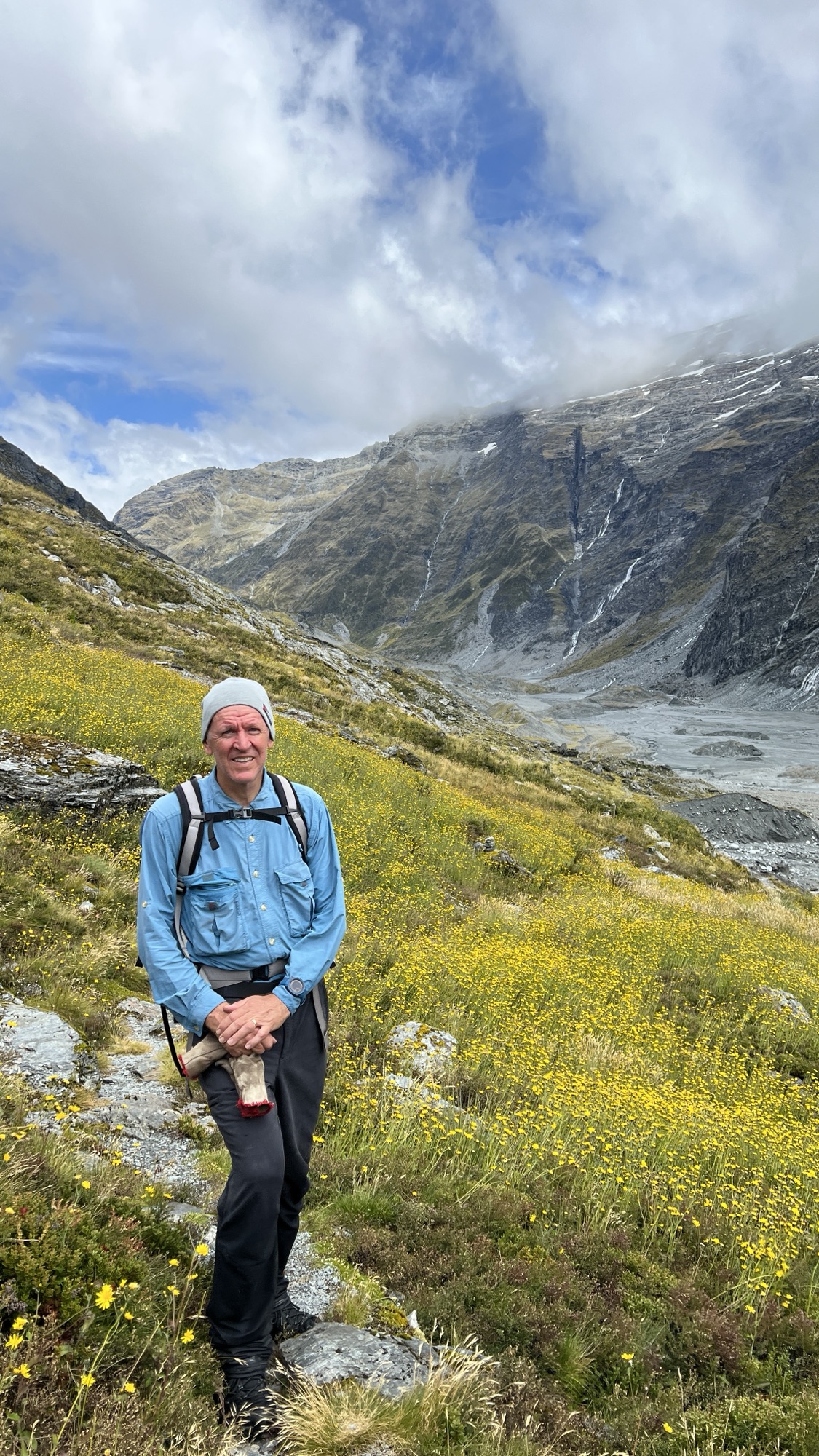
The upper Dart Valley is spectacular. It’s wide and mostly flat. It’s flanked by mountain ranges topped with glaciers that constantly feed the many waterfalls tumbling down the bare rocky slopes.

The track is quite clear on the eastern side of the valley. At one point the river had eaten into the side of the valley and removed the track. At this point there were cairns and markers leading up the hill and there was a rough footpad to follow. Eventually the footpad descended back to the valley floor.
As I continued up the valley a helicopter approached. I discovered on my return to the hut that the helicopter belonged to the Department of Conservation, and that a ranger had looked at the avalanche up ahead, and was planning to mark a new route.

I got to the head of the valley. There is a warning sign when you arrive at the Dart Glacier. It’s difficult to see the glacier at first because it is covered in gravel and the ice isn’t apparent.

From here the track climbs the southern side of the valley, rising steeply towards the Cascade Saddle. I followed the cairns and markers up the hill for a few hundred metres. Now the track disappeared into a recent gouge created by an avalanche. This was the place that had been mentioned in the logbook at the hut.
I continued uphill off track and discovered that the markers reappeared further up the hill. I continued to follow them but, again, they disappeared into the gouge.

At this point I crossed the avalanche. The ground was very loose, but it was traversable and, on the other side of the gouge, the track reappeared.
I continued following the track up to a point where it reached a scree slope. 200m away, at the top of the slope, I could see another marker. However, I wasn’t convinced that the slope was stable and there were no footpads or markers to indicate a route across. So I turned back at this point.

As I retraced my steps back down the hill I met the family from Noosa coming up the hill. We talked about the avalanche and the difficulties of climbing further. They also decided to turn back at this point.

The views of the Dart Glacier and the river valley were spectacular from the hill as I descended. There are large blocks of ice in the river valley broken off from the glacier. I imagine that the water is freezing, but I wasn’t brave enough to try.

On my return trip I passed a young German woman. She told me that she intended to climb up to the top of Cascade Saddle and then proceed onwards to Aspiring Hut. I didn’t see her back at Dart Hut that evening, so I presume that she was successful.
I returned to the hut by mid afternoon, and had a relaxing time with the other people there. It was the same group as I had been travelling with since I began the walk. Ranger Emma was also in residence but was staying in the ranger’s hut nearby. She told us she planned to mark a new route up to the Cascade Saddle the next day.

