When I woke up the sun was shining and the skies were clear. It was perfect weather for our walk.

After breakfast, I started walking with Phil and Andy. The first stop was within five minutes of the hut, when the track climbs up next to the Routeburn Falls.

The next 3km of the track is a steady climb around a valley created by the Route Burn. The vegetation is sparse and at times the track crosses over scree slopes.

The scenery is spectacular looking across to Mount Xenicus and framed by mountains on all sides.

As the track climbs, views down the Route Burn valley expand.

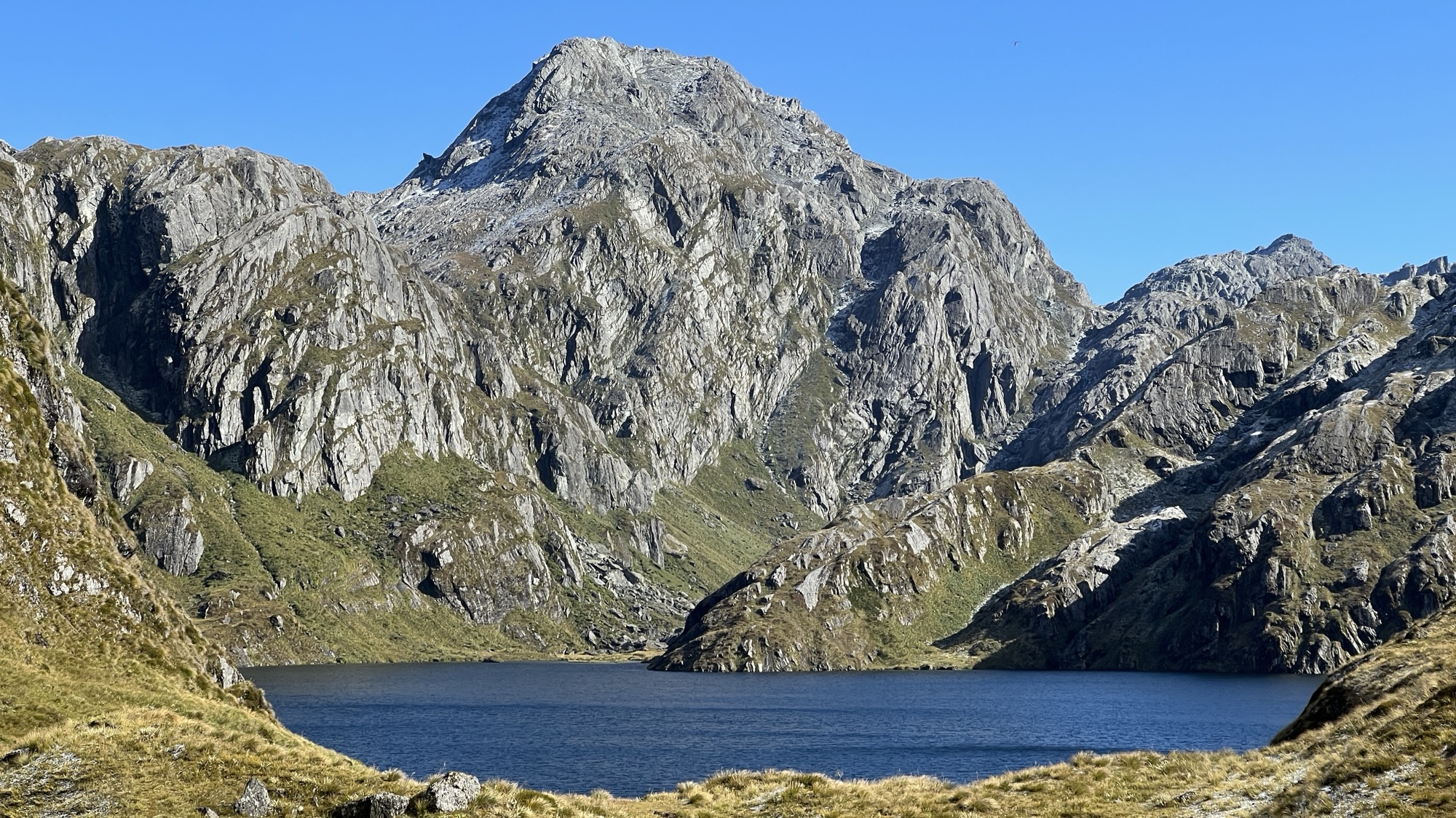
The track continues to climb until views of Lake Harris, which is perched higher above the valley, become visible.

Eventually the track crosses over the Harris Saddle, and the next valley (the Hollyford River) becomes visible. There is a large shelter located at the saddle. It is actually two shelters, one of which is reserved for people using commercial guides.
I had some morning tea in the shelter, which was crowded with other walkers who had set off from Routeburn Falls Hut that morning.

I then set off on a side trip up Conical Hill, a climb of 260m. There is a clear track up to the summit of Conical Hill and, whilst it is steep, it is easily negotiable.
From the summit there are 360° views of the Serpentine Range to the north, the Darran Mountains to the west, the Alisa Mountains to the south, and the Humboldt Mountains to the east. It was a clear day and I could see all the way down the Hollyford River valley to the Tasman Sea.

From the northern side of Conical Hill I could see the Routeburn Track rising up from Routeburn Falls to the east, and then continuing around the other side of the Alisa Mountains towards Lake Mackenzie.

Phil also made the side trip up to Conical Hill and, after a chat on the summit, I descended back to the Harris Saddle shelter where I had lunch.
After lunch, I continued on the track for 4km. This part of the track traverses on the upper slopes of the Hollyford River valley. After 4km, the track makes a sharp turn to the east and Lake Mackenzie becomes visible below.

The track descends steeply towards Lake MacKenzie through a number of hairpin bends. The track in this location is not as smooth as it is elsewhere, and the going is a bit slower. Andy, in particular, was not keen on this part of the track.
As the track approaches Lake Mackenzie the vegetation changes and enters a forested area. It was here that I found an owl next to the track. It was in a tree and looked at me for a minute or two, with a regular movement of its head and a quiet screech. The owl had a partner in another tree about 15m off the track.
Lake MacKenzie Hut is situated on the banks of the lake. There are grassy areas for lounging and, for people who didn’t mind freezing water, it was possible to have a swim. I got into the water up to my ankles, and that was enough for me.

I then took a side trip to Split Rock. This rough track follows the shore of Lake MacKenzie for about 20 minutes. Split Rock is a monolith that is split down the centre. It’s possible to walk through the split, although I didn’t try.

I fthen returned to MacKenzie Hut. After dinner we had the usual presentation by the hut ranger. He had an amusing sense of humour that was so dry that it could be described as “arid”.

The excitement that night was a false alarm on the fire detection system. The hut ranger had warned us that this might happen. At 11pm, as the alarm sounded, all the walkers casually left the hut and gathered outside. The hut ranger sheepishly told us that he would need to look at the alarm and see if there was some way of preventing it from randomly going off.
