Show me dat stream called de river Jordan,
Oscar Hammerstein II.
Dat’s de ol’ stream dat I long to cross.
Having finished hiding my food drops I drove to Walhalla. I left my car in the car park opposite the post office. I spoke to the nice lady who runs the post office and she said she would keep an eye on the car. The Tangerine Dream is not hard to miss.
By 10.15am I was ready to go. Every walk, long or short, begins with a single step. So I took my first step.

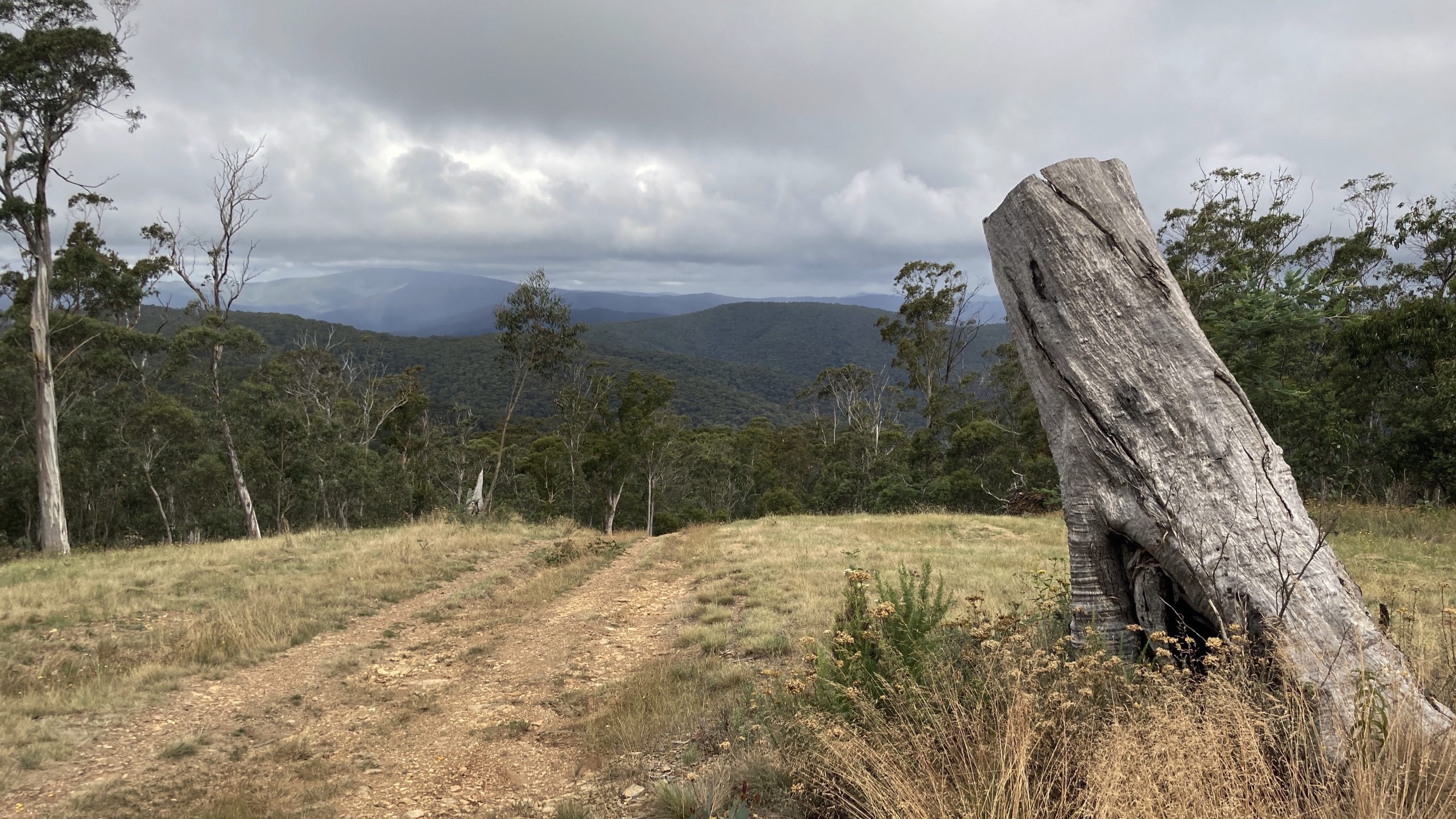
The track climbs up behind the rotunda where it joins an old tram line. The tram line was originally built as part of the Walhalla mining works to move timber and workers to the mine. You get views over the township.

Shortly afterwards, I pass a sign showing me how far I have to go. At this point it’s all quite exciting.

I followed the level walking track for 4km where a sign stated that the Poverty Point bridge was closed and I needed to detour. A steep 150m descent to the road bridge over the Thomson River.
I missed the next turn-off on the detour route, adding about 1.5km to my day’s walking. Back on track and I followed the trail on the western side of the Thomson River for 3.2km to the Poverty Point bridge.

The track climbs 350m over the next 3km as I farewell the Thomson River (I will see it upstream in a few days) and climb the Fingerboard Spur.
After that climb I was thankful for the gentle descent over the next 2km to my campsite at the East Tyers (O’Sheas Mill) Campground, where I was the only visitor.
Day 2 begins with a 700m climb, up to the end of the Mt Erica Road. I take a short break at the end of the road. Then it’s up past Mushroom Rocks and into the Baw Baws.
Really nice walking here. Spotted this old track marker from the early days of the AAWT, slowly getting devoured by a tree.

I continued walking over Mt Erica and past the Talbot Hut ruins to Rock Shelter. Here I dropped my pack and took a little side trip to Mt St Gwinear for views of the region and to check out the mountain wildflowers.

Then back to Rock Shelter to camp for the night, picking up water in the creek nearby.

There was a thunderstorm overnight and the morning of Day 3 dawned misty and moody. Nice walking weather.

After an enjoyable morning’s hike I sat on a log and made some sushi for lunch. Then the route joins an old logging track for the descent to Stronachs Camp, and the landscape becomes less interesting.
The next part of the walk is forgettable as the track descends then follows a road to the Thomson River campsite, where I stopped for the night.
There used to be a log bridge across the Jordan River, but it was washed away shortly before I arrived. The next morning (Day 4) I waded across, not knowing how deep it was. Fortunately, it never got higher than the “plimsol line” (ie: my hips).
Then another long climb (450m) and descent into the Jordan River catchment. The forest around Mt Easton is awe inspiring.

There are the ruins of old gold mining settlements at Blue Jacket and Red Jacket on the Jordan River that I checked out.
Then a 600m climb to Mt Victor, passing a through-jogger coming the other way. He told me he was 17 days into his trip and, at his pace, only 2 more days to go to reach Walhalla.
I found a lovely campsite next to a side track and settled in for the evening.

Water was difficult to find the next day (Day 5) and I had to walk 800m down a side track at Fiddlers Green to find a trickle.
I had a long descent to the Black River, where I stopped for lunch. Then I crossed the river on a log, being careful not to overbalance.

That evening I made camp on the track below Mt Shillinglaw, on a very small clearing just big enough for my tent. I listened to the bush creatures as I fell asleep.
By lunchtime on Day 6 I was at Mt Skene where I had my first food drop. It took me 1.5 hours to open the sealed bucket containing my food and fresh clothing, and at times I wondered if I would be able to proceed. Eventually, using brute force and tent pegs as levels, I got the bucket open.
I’m going at an easy saunter, and shuffle up the steep climbs a la Cliffy Young (if you haven’t heard of him, do the research!). A prominent public figure said “it’s not a race”, which has been my approach. Notwithstanding, I didn’t expect to get here until tomorrow night.
Physically, I am all good – no cuts, bruises, strains or blisters. Mentally, I am just the same.

I carried 4 litres of water from Mt Skene to last me through the next day. I found a lovely campsite beside the track near Mt McKinty.

The next day (Day 7) I continued on a ridge to Mt Sunday, then descended to Low Saddle. I attempted to find water from a side creek on the descent but had no luck.
Once at Low Saddle I attempted to find water on creeks crossing the fire trail to the north, but again no luck. Finally, I started walking to the west and found water crossing the fire trail about 400m from Low Saddle. It was just a trickle, and I needed to use a plastic sandwich bag to scoop it up.
By this stage I was tired, even though it was mid-afternoon. I pitched my tent, had a snooze, and celebrated having completed the first week of my walk.
Some progress totals:
Steps: 190,000
Snake sighted: 1
Leaches sighted: 1
Other AAWT walkers sighted: 1
Flies sighted: quite a few.
