Rain. Not heavy rain, but New Zealand rain. Wet, misty, thick. Like a cold atmospheric soup, a vichyssoise in thin air. At least it wasn’t windy.
Phil, Rachel and I decided to sit it out in the hut for a while and see if the rain eased up. It was getting lighter, but it was still set in so at 10 am we decided to get walking.
There had been keas on the balcony of the hut in the morning, and there was a kea following Rachel as she walked up the track a couple of hundred metres from the hut.

The track climbs gradually for the first 3 km. At one stage it crosses a loose, shale, scree slope, and then sweeps around the flanks of Mount Luxmore.

There is a side trip up to the peak of Mount Luxmore (1472m) and I decided to take 15 minutes to walk to the peak. When I got to the peak it was clouded in and there were no views available. It seemed that I was the only person who was bothered with making the side trip given the way the weather was so set in.

After Mount Luxmore, the track continues for another 1.5 km along the ridgeline and traversing around any high points until it reaches the Forest Burn emergency shelter. I stopped at the shelter to have some morning tea, and also used the toilet there which, unusually, did not have a door at the time (I had been warned about this by the Ranger the night before).
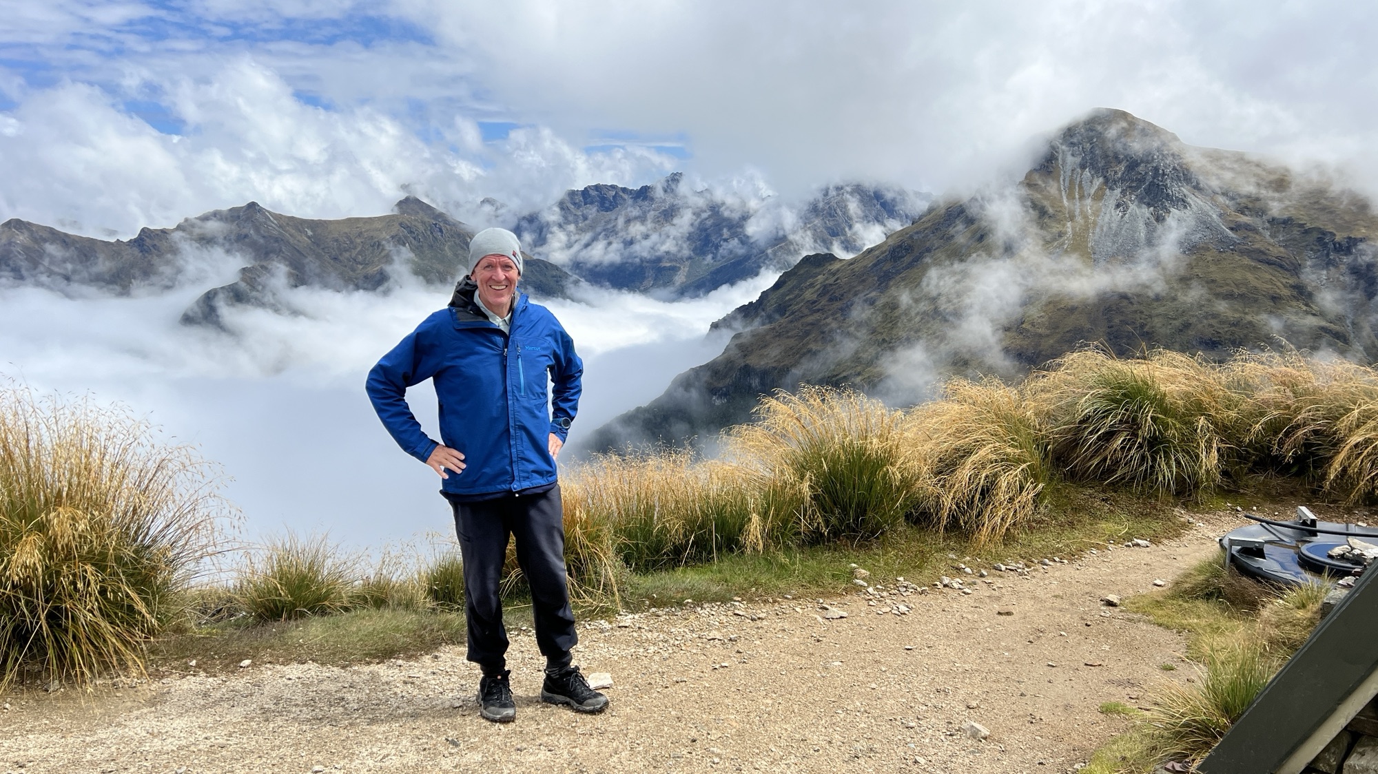
I then continued on the track which crosses a saddle, and then continues to traverse around the high points of the ridge. My brother, Phil, took my photo at one point on a rock that was supposedly a lookout. At the time all I could see was mist.


At last the weather began to clear, and I could see the views that I had been missing. There were extensive views in all directions, and you could see the track clinging tightly to the top of the ridge.

At Hanging Valley shelter I had another break. The shelter has a toilet that is scenically located.

While I was at Hanging Valley shelter my sister Rachel arrived. We had a chat and some afternoon tea.

There were quite a few people at the shelter because the weather had finally cleared, and they were all enjoying a bit of sunshine at last.

After leaving Hanging Valley shelter the track begins to descend along the ridgeline. After about 1.5 km, the track finally leaves the ridge and begins a steep descent to the west towards Iris Burn.

The track down to Iris Burn is extremely steep and, following the rain over the past 24 hours, it was wet and slippery. Rachel told me later that she was followed by a kea for about 500 m down the track (she seems to be on very friendly terms with the birds).

I reached Iris Burn Hut in the late afternoon. There were sandflies in the area, so I stayed inside the hut. There were also kea roaming the grounds and threatening to take any loose items of clothing that were left out to dry.

