Before the walk began.
My transport to the track head left central Queenstown (Info & Track) at 8 am, so I was up early and all packed and ready to go.
The coach to Glenorchy takes 45 minutes. The coach driver told us that this was one of the 10 most scenic drives in the world. And who could disagree given the views of Lake Wakatipu along the route. At Glenorchy, we transferred to a minibus.

There had been seven people booked onto the minibus but, with wet weather forecast for days 2 and 3 of the walk, four people had cancelled their booking. So there are only three of us on the minibus to the track head.
We arrived at the Muddy Creek car park at 9:30 am and, after some introductions, began our walk.
Walking up the Rees Valley.
My walking mates were two women. Jenny was a Kiwi nursing professional and an experienced walker. Kirsten was a German woman who had been living in Melbourne for the past four years completing a PhD in disaster management. They knew each other from having walked in Nepal 10 years earlier.

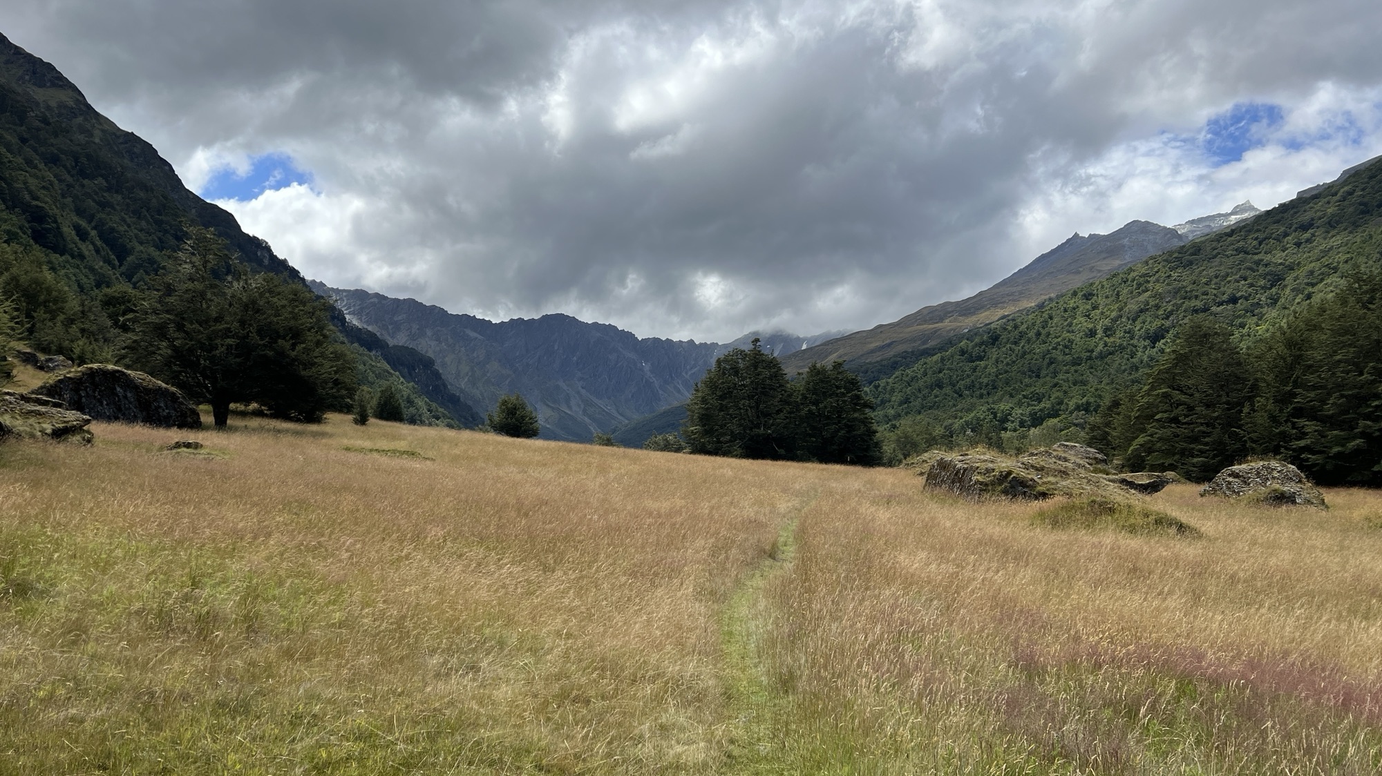
The walk begins by following the Rees Valley upstream. The valley at this point is very wide and grassy, and is used for grazing.

The valley is also quite boggy in places. At one point I led my companions straight into an extremely boggy area where we found ourselves up to our thighs in water and mud.
After 30 minutes of walking we met a man who was very happy to see us, particularly Jenny. It turns out that he was an animal trapper for the Department of Conservation. He knew Jenny from a previous time where she had assisted the Department of Conservation with their feral animal trapping activities.
The weather was moody but dry and we enjoyed the walk up the valley (with the exception of the bog). There were views across the valley to Lennox Falls, and up the valley to the mountains that awaited us.

Entering the National Park.
After three hours of walking we entered the Mount Aspiring National Park. Here the landscape changed significantly as the valley began to close in. We moved out of the open grazing areas into dappled forests.

The track soon crossed from the eastern side to the western side of the Rees River over a swing bridge.

The track continues to follow the Reese River upstream, sometimes through forests, and then opening out into alpine meadows.

As the track gains elevation the vegetation changes, becoming more stunted and the landscape more open.

End of Day 1.
By mid afternoon we had moved 15kms up the Rees Valley. There was one more swing bridge to cross.

We reached the Rock Shelter Hut, which was our accommodation for the night. The hut was comfortable, with a common kitchen and dining area, including sinks and stoves.

Joining us was a family from Noosa, Australia. The parents with two adult children and a partner. As events transpired, these would be our walking companions for the next three days.
The afternoon and evening was spent drying out wet shoes and clothing, cooking dinner and chatting. I decided to sleep in the common area where there were a few bunks. The others slept in the separate bunk rooms. Given there were only eight of us staying the night there was plenty of room for everyone.
